

Foundation Publishes Reprint of Gray Map of Louisburg
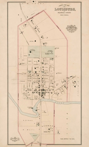
The Tar River Center for History and Culture Foundation has published a high-quality reprint of Gray’s New Map of Louisburg, Franklin County, North Carolina, which originally appeared in The National Atlas (Philadelphia: O. W. Gray & Son, 1882).
Information about this important map is available here.
Printed on heavy acid-free paper and measuring 31 x 18 inches, the maps are suitable for framing. The cost of the maps is $20; proceeds from sales will support the work of the Tar River Center for History and Culture at Louisburg College.
These handsome maps will be available for sale by appointment at the Franklin Male Academy building on the college campus. The academy building is located on Cedar Street in Louisburg. Copies can be mailed for an additional charge of five dollars. Mail orders should include a check for $25 made payable to the TRCHC Foundation and mailed to Maury York, TRCHC director, at Louisburg College, 501 North Main Street, Louisburg, NC 27549.
For additional information, contact Maury York at (919) 497-3252 or at myork@louisburg.edu.